

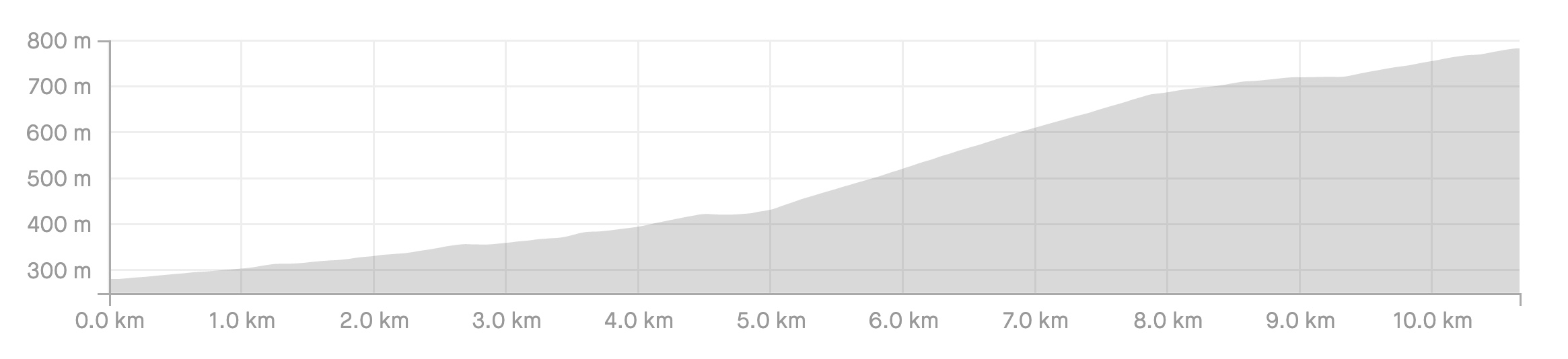
Length: 10.7km
Average gradient: 4.7%
Elevation gain: 501m
Introduction
The Myrtleford-Stanley Road was only fully sealed in late 2012 making this climb relatively new for most road cyclists. The average gradient of roughly 5% might suggest a steady ascent but in reality this climb can be broken into three sections: an easy start, a challenging middle section, and a rolling finale.
The start
The Myrtleford-Stanley Road climb begins where the road starts, at its intersection with the Myrtleford-Yackandandah Road (C527).

The finish
The Myrtleford-Stanley Road climb ends at a small crest, 10.7km from the start of the climb and roughly 3km from the township of Stanley. The crest comes just after an orchard on the left-hand side of the road and just before Thorley Road on the left.
At a glance
- A climb in three parts: an easy warm-up, a tough middle section and a rolling finish.
- The first section is 5km long and climbs very gently.
- The steeper second section starts after 5km and climbs at roughly 9% for 2.9km.
- The final section runs from 7.9km to the end (2.8km) and features some flat sections.
Climb details
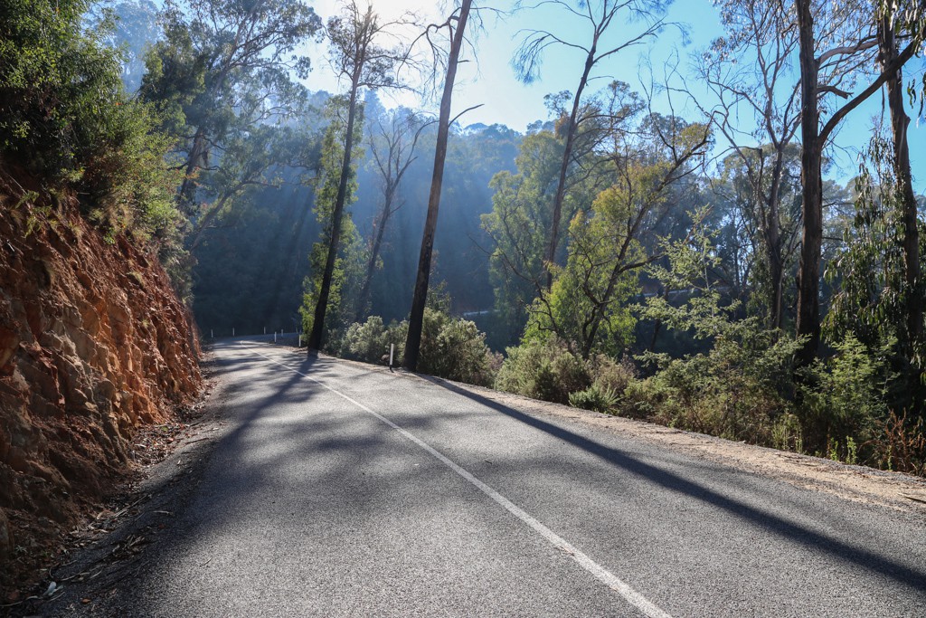
Some cycling climbs throw you right in the deep end with steep ramps right off the bat but Myrtleford-Stanley Road isn’t one of those climbs. The first 5km are very gentle, providing a nice warm-up for the challenging section the follows.
From its intersection with the Myrtleford-Yackandandah Road, the Myrtleford-Stanley Road climbs at the gentlest of inclines as the road passes by the Mt. Stanley Scenice Reserve on the right.
Passing farmland on the left to begin with and then plantation forests roughly 1.3km from the start, the road winds gently up the hill for the opening kilometres. If you’re pushing yourself for a good time on this climb you should be in the big-ring for these opening kilometres, powering along.
It’s not until the 3.4km mark that the gradient increases slightly, and even then it’s only to around 3-4%. At this point you’ll start to notice a gorge opening up on the right-hand side of the road; a sign of things to come.
After 4.1km the road is noticeably windier than it has been thus far. It’s also considerably more enclosed, the open farmlands left behind for thick tree cover on either side of the road.
The road flattens off briefly after 4.5km as you head around to the right and 400m later the road kicks back up again, to about 3%. It’s at the 5km mark that the real climbing begins.
As you head around to the right you are presented with a big red sign which reads “Danger. 2km narrow, steep, winding road. Drive with extreme caution”. It’s at this point that the gradient increases.
As the road gets steeper and the mountain drops away to your right, great views start to appear on the right-hand side of the road. While there are great views throughout most of this middle section, arguably the best views happen at the 6.7km mark.
The steepest part of this climb is less than 3km long but it’s in this section that a large percentage of the climb’s elevation gain is achieved. The gradient is quite consistent, hovering at around 8-9% throughout as the narrow road winds along the western edge of the Mt. Stanley Scenic Reserve.
After 7.5km the road takes you away from the ridgeline and trees surround the road once more. The gradient still remains at around 7-8% but the tough middle section is just about over.
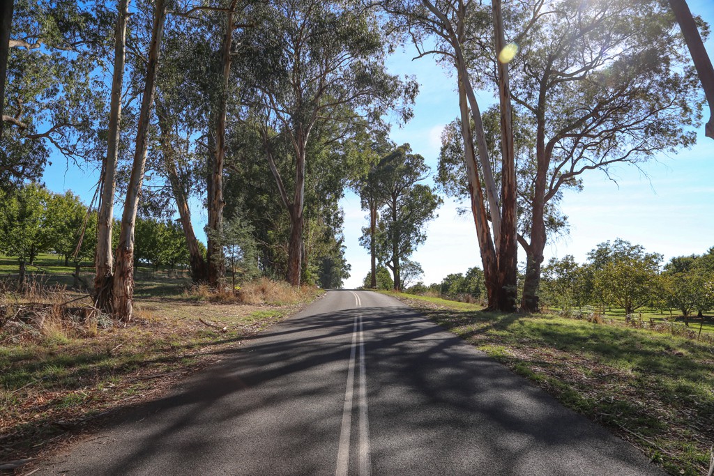
After 7.9km the road bends around to the right and flattens off to around 4%, marking the end of the sustained climbing. At 8.2km the road flattens off even further, to around 2-3%, and another 400m up the road the road is completely flat as it passes between two gorgeous rows of trees.
At the 9km mark the road is climbing at only 1-2%, and 300m later, as you bend around to the right and through the trees, the gradient increases to around 4-5%. After 9.8km of climbing you come out of the bush once more, passing orchards on your right.
Some 10.3km from the start of the climb the road is briefly flat before the gradient increases to around 3-4% for the final 400m to the top. The climb ends at a crest in the road. If you’re worried about missing the top, just look out for Thorley Road on the left which comes just after the crest.
Profile
Location
The Myrtleford-Stanley Road climb can be found in the alpine region of Victoria, starting 10km north east of the regional centre of Myrtleford and ending roughly 3km from the township of Stanley. Both Stanley and Myrtleford are roughly three hours drive from Melbourne via the Hume Freeway and the Great Alpine Road and in the case of Stanley, the Beechworth-Wangaratta Road.
Stanley is roughly 60km (an hour’s drive) from Bright, one of the more well-known towns in the Victorian Alps.
Times
The Strava file for the Myrtleford-Stanley Road climb can be found here.
The photos along the 2017 Sun Tour route so far certainly justify the race letting us from the Far West know how beautiful rides can be. Thanks for the Twitter posts everyone involved.
Hey Matt,
Mt Stanley is the 1000m+ summit just 3kms to the East of the “Back ‘o Stanley” climb. Initially approached via Hillsborough Rd from Stanley village. Zoom into to the Google map for a better view.
Thanks for the great description and photos of the “BoS”..! Fraser
Yep this great climb is now one of the “faves” of the local Beechworth LFZ roadies group, most Saturday and /or Sunday mornings there’ll be some of us spinning, or grinding, our way up it.
On Sat Nov 22nd 2014 the Indigo Classic Audax, last run in 2009, returns to NE Vic with partially supported 100/200/& 300km rides finishing up this 500m climb, yep locals tip is “PACE yourself”!!
Online entries open early 1 Nov and close late Wed 19th Nov.
Great training rides for that other big hilly Audax held out of Bright in late January each year.
More info on the Audax Australia website http://www.audax.org.au/public/index.php/ridecalendar
Just did the ride up to Stanley, was pleasantly surprised to find a cafe .Wow muffins were to die for and illy coffee,haven’t had that since I left sydney.
Was worth the ride
Are you sure about the 6-7% gradient? I get 10% for 3km on my Garmin, and it sure feels like the 10% European climbs I’ve done, not 6-7%
I’m not quite sure about the bit straight after the sign, but you’re right, that 3km stretch is steep. I’ve just double-checked the elevation details in Strava and Google Earth and both give an average gradient of close to 9% for that 3km stretch. I’ve update the post to reflect this. Thanks for your comment!
Thanks Matt.
I’ve driven this road before and so had decided to use it as a warm up ride before the alpine classic this year. Your preview has come just in time.
I”ll post a few more thoughts once I’ve ridden it.
A great loop is Beechworth to Myrtleford via the Buckland gap. Myrtleford to Ovens then up Carrolls Rd to Mudgegonga, then up to Stanley and back to Beechworth for a few pints at Bridge Road brewers
After reading about this climb and realizing that Seane’s suggested loop was about the right distance for me, I followed this route a few weeks ago. 22 degrees and humid on departure from Beechworth, 16 degrees and raining in Myrtleford, 25 degrees and a howling headwind at the base of the climb – found myself in my lowest gear on the 3-4% sections! Fortunately the steep bit was well sheltered.
Overall, a really enjoyable ride. Spot on 80 KM in total to/from my Beechworth motel room. And the beers at Bridge Road were the perfect recovery. Thanks for the suggestion Seane.
I tried the Back of Stanley climb for the first time on Saturday. It is a beauty. Great views of Mt Buffalo from about half way up. Like Matt said, the steep part starts from the big red sign.
I included the Back of Stanley climb in a 100km loop from Myrtleford. The road up to Stanley was very quiet, but the Beechworth-Wodonga road was very busy and dangerous. Follow the Strava link if you want to see my route.
http://app.strava.com/activities/97770058
Love riding this area and the Stanley climb is a great new addition. Watch out for the loose gravel built up on the shoulders from the new surfacing, it caught me out on a corner while descending not long ago, escaped injury but experienced more of the lower valley than I planned!
The only detail left off this excellent article is the reward at the end and that’s Stanley itself.
The beautiful Stanley Pub, a great place to end a ride with first class food and drink. There’s also the Athenaeum with an extensive collection and enthusiastic staff. A fruit shed that sells local produce and a cafe shop that is intermittently open. Beechworth is a further 9km on too. Enjoy the climb!
+1. The Stanley Pub is great with excellent food. Always pleasantly surprised.
Having family in Myrtleford, I have known about this climb for quite a while now, and have eagerly awaited the sealing of the road. Its a beautiful climb, especially first thing in the morning.