Skip to content

The Climbing Cyclist

The joy of riding uphill & a guide to Victoria's best climbs.

  • Home
  • Climb guides
    • Arthurs Seat
    • Boroka Lookout
    • Buckland Gap
    • Chum Creek Road
    • Dinner Plain
    • Falls Creek (Mt. Beauty side)
    • Falls Creek (Omeo side)
    • Humevale Road
    • Inverness Road
    • Kinglake
    • Lake Mountain
    • Mt. Baw Baw
    • Mt. Buffalo
    • Mt. Buller
    • Mt. Buninyong
    • Mt. Donna Buang
    • Mt. Hotham
    • Mt. Macedon (Gisborne side)
    • Mt. Macedon (Woodend side)
    • Mt. William
    • Myrtleford-Stanley Road
    • One Tree Hill (Ararat)
    • Panton Gap (Healesville side)
    • Perrins Creek Road
    • Reeds Lookout
    • Skenes Creek Road
    • Skyline Road
    • Tawonga Gap (Bright side)
    • Tawonga Gap (Mt. Beauty side)
    • Terrys Avenue
    • The 1 in 20
    • The Crescent
    • The Devil’s Elbows
    • The Wall
    • Wild Dog Creek Road/Busty Road
  • The science of climbing
    • Gradients and cycling: An introduction
    • Gradients and cycling: How much harder are steeper climbs?
    • Science of climbing: Why power-to-weight ratios matter
  • About
  • Contact
  • Archives
  • Buy my book!

Tag: Myrtleford

Posted on November 14, 2016February 1, 2022

A ride down memory lane: Bike Camp revisited

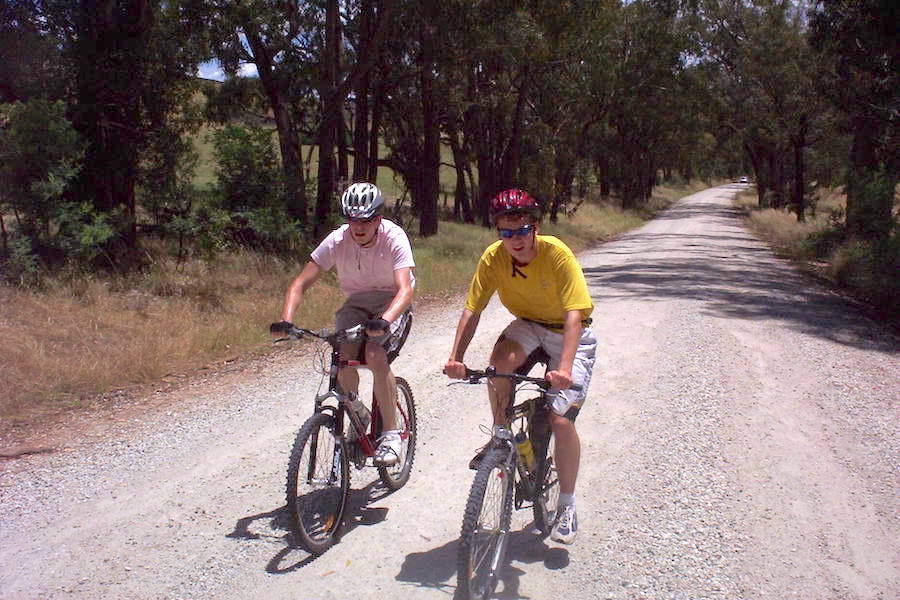
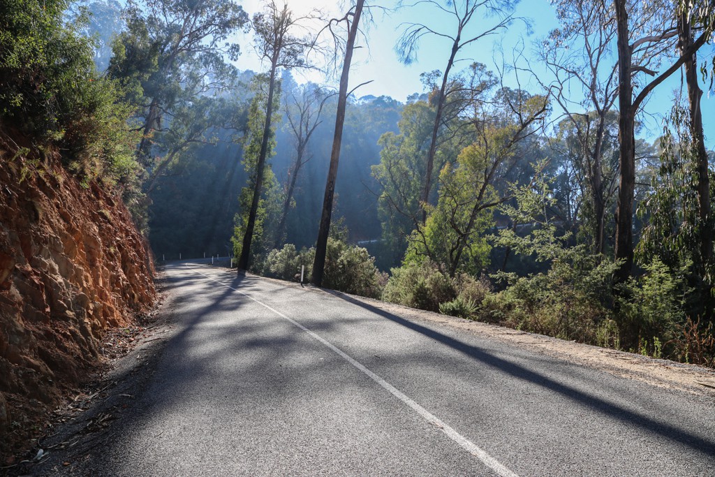
Not all rides have great meaning to them. Much of the time it's about simply getting from A to B, or staying fit, or clearing your head. But sometimes there's a ride that stands out, that has a significance much greater than the distance covered or how fast your rode. A recent ride down memory lane with my mate Nick was one of those rides. Read more “A ride down memory lane: Bike Camp revisited”
Posted on November 27, 2013November 27, 2013

New climb guide: Myrtleford-Stanley Road

The Myrtleford-Stanley Road climb is 10.7km long with an average gradient of 4.7% but a tough middle section makes the climb more challenging than those numbers would suggest. Click through for the full climb guide. Read more “New climb guide: Myrtleford-Stanley Road”
Posted on February 15, 2011

Episode 18: The high country double-header

Route: Myrtleford to Dingo Dell, return
Distance: 109.5km
Duration: 5 hours 4 minutes

Part of me wishes that the Victorian Alps were a little closer to Melbourne. That way, you wouldn’t have to spend 3.5 hours to get to … Read more “Episode 18: The high country double-header”

TCC on social media

Updates to my 'Everesting' book

Follow the link to see what's changed since the book came out in September 2021.

The science of climbing

  • An introduction to gradients
  • How much harder are steeper climbs
  • Why power-to-weight ratios matter

Climb guides

  • Arthurs Seat
  • Boroka Lookout
  • Buckland Gap
  • Chum Creek Road
  • Dinner Plain
  • Falls Creek (Mt. Beauty side)
  • Falls Creek (Omeo side)
  • Humevale Road
  • Inverness Road
  • Kinglake
  • Lake Mountain
  • Mt. Baw Baw
  • Mt. Buffalo
  • Mt. Buller
  • Mt. Buninyong
  • Mt. Donna Buang
  • Mt. Hotham
  • Mt. Macedon (Gisborne side)
  • Mt. Macedon (Woodend side)
  • Mt. William
  • Myrtleford-Stanley Road
  • One Tree Hill (Ararat)
  • Panton Gap (Healesville side)
  • Perrins Creek Road
  • Reeds Lookout
  • Skenes Creek Road
  • Skyline Road
  • Tawonga Gap (Bright side)
  • Tawonga Gap (Mt. Beauty side)
  • Terrys Avenue
  • The 1 in 20
  • The Crescent
  • The Devil's Elbows
  • The Wall
  • Wild Dog Creek Road/Busty Road

SEARCH

SOCIAL

Proudly powered by WordPress. Twenty Seventeen theme modified by Matt de Neef.