
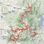
Route: Heathmont to Thornbury, via The Crucifix
Distance: 119km
Duration: 4 hours 39 minutes

I made two mistakes on Saturday morning. The first was a failure to look at the weather forecast before leaving the house. The second was underestimating the ride known as The Crucifix. When a ride is named after a device that was designed to kill people, it’s probably worth taking seriously.
With Brendan working all day and the Donvale Demon still recovering from his nasty fall at Mt. Baw Baw it was time for me to self-motivate and head out for a solo ride. I now realise why I did so little training for last year’s 3 Peaks – I had to do most of my training alone and riding by yourself is, well, not all that much fun.
After whinging and moaning for a while, I drove out to Heathmont, parked the car and rolled out toward The Basin. My plan at that stage was just to head up the 1 in 20 and see how I felt — maybe get in a couple of climbs and then ride home. But as I climbed the 1 in 20 I decided I’d give the ol’ Crucifix a go. How hard could it be? After all, it’s only four climbs with some flats and descents in between. Easy.
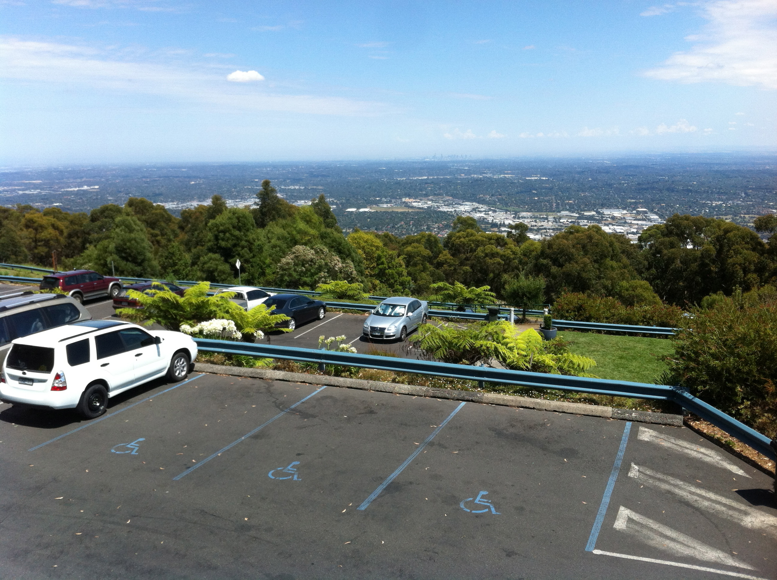
At Sassafras I took a left and headed up the Mt. Dandenong Tourist Road to Olinda and then up to Sky High. I didn’t want to stop for long so after refilling my bidons, I rolled down Ridge Road and back to the Tourist Road.
By this time it was starting to get pretty warm and as I started climbing Inverness Road I realised the heat was already taking its toll. I managed to get up and over the climb without too much trouble, taking a minute off my PB thanks to a gut-busting push through the climb’s final steep section. I limped back on to the Tourist Road and headed toward Ferntree Gully.
It’s worth mentioning that there seems to be some conjecture about the “correct” way to approach The Crucifix. For example, Cycle2Max suggests starting with the 1 in 20 before heading straight down to Burwood Highway to climb the Devil’s Elbows second. Bikely suggests the 1 in 20 first, up to Sky High, down and up Inverness Road and then back up to Sky High. MapMyRide also suggests the 1 in 20 and then Inverness Road, but with an additional few kilometres along York Road and without heading back up to Sky High.
I’d be willing to venture that it doesn’t really matter what order you do the climbs in, so long as you do all four.
After Inverness Road I followed the Tourist Road right down to its end in Upper Ferntree Gully, touching 80km/h in the process. I must admit that the Donvale Demon’s blowout on Baw Baw has left me pretty spooked when it comes to descending, and for every second of that descent I was trying to stop myself from thinking: “What happens if my tyre blows out here?” I can only imagine how the Demon must be feeling on the bike.
But I reached the bottom of the hill in one piece and turned around, starting on the third climb of the day. In many ways, the Devil’s Elbows climb reminds me of the Tawonga Gap (Mt. Beauty side) climb, the huge left-hand hairpins in particular. That said, the Elbows’ climb is steeper (but shorter) and in the heat, and with dwindling water supplies, I was certainly feeling the burn.
After 3km of grinding I took a left at Churchill Road and got started on the second part of the climb. This was only the second time I’d climbed Churchill Road/One Tree Hill Road and both times it’s been harder than I expected. When you look at the road in front of you, the gradient doesn’t seem that high and yet it always seems to be very slow going.
It was a relief when I reached the top of the hill — by then I was well and truly looking forward to a drink and something to eat. But such luxuries would have to wait — there was still one more climb to go: The Wall.
I headed down Sherbrooke Road to Monbulk, noticing, to my great annoyance, that the tendon pain I’d had in my right knee a few weeks earlier had returned. It’s not the most excruciating pain, but it’s enough to make pedal strokes slightly painful and to make me anxious about its potential return during 3 Peaks.
I started The Wall feeling tired and got to the top feeling exhausted. It’s not the hardest climb in the world at only 5km in length, but by this stage it was getting really hot, I was fatiguing quickly and I was dehydrated and hungry.
I rolled through Olinda, back down to Sassafras and back down the 1 in 20 to The Basin where, I’d promised myself, I would have something cold and sweet to drink. I did just that, smashing down a Coke while lying on the grass across the road from the Basin shops. It was at that point I realised just how hot it had become. Without the benefit of altitude (albeit 600m) the temperature was in the high 30s and I was feeling it.

After filling up my bidons I rolled out of The Basin and out toward Boronia. I was headed for the Eastlink Trail which would take me all the way back to Chandler Highway and towards home in Thornbury (my partner Sharon was picking up our car from Heathmont). But I had to get to the Trail first.
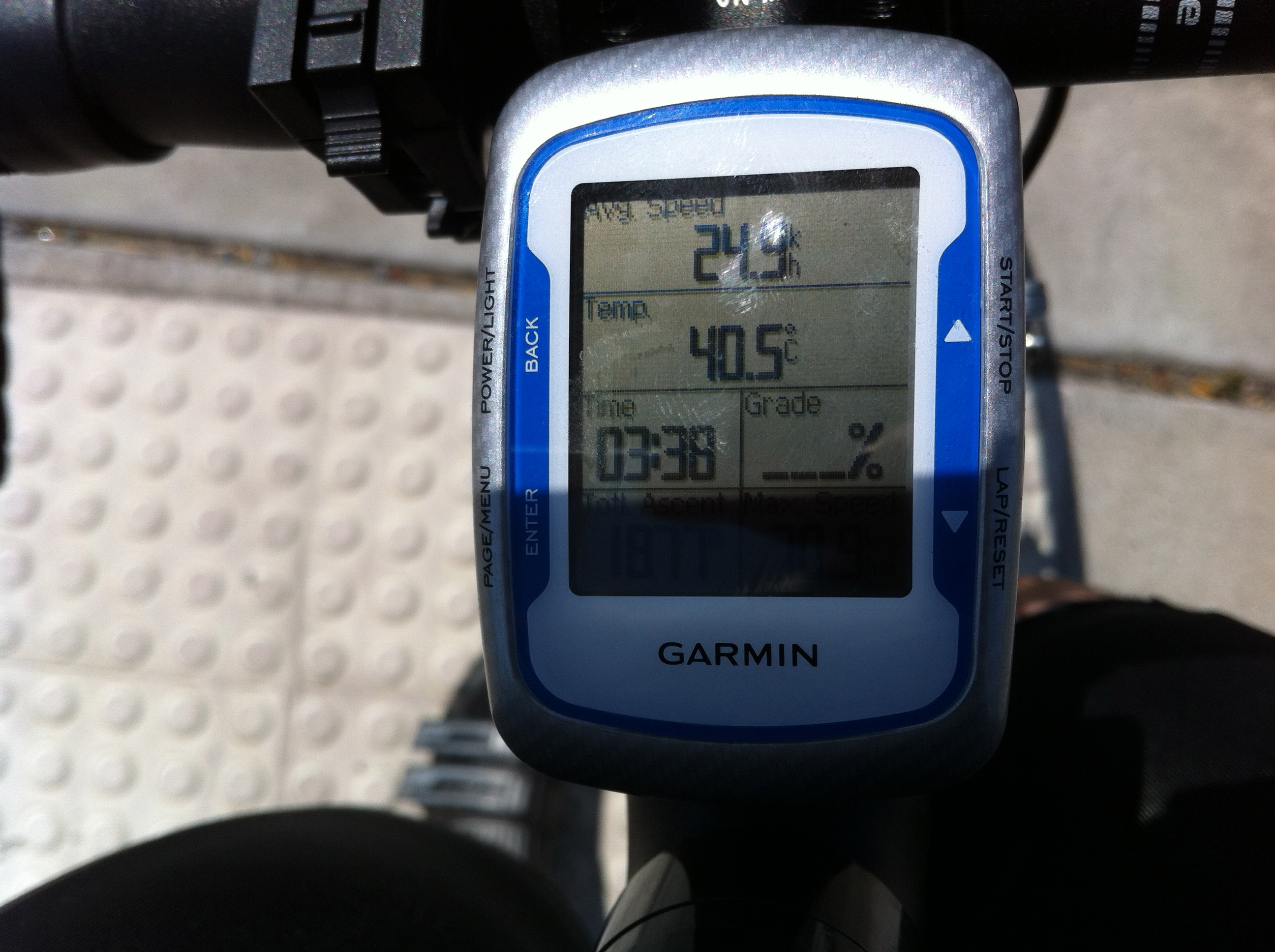
Away from the trees, and with the heat blasting back off the road, the temperature was above 40 degrees according to my Garmin. In fact, the unit was reading 41.2 degrees for most of the way from The Basin to the start of the bike track.
The ride back home along the Eastlink Trail saw the temperature drop below 40 degrees but not far enough for my liking. I was hot, dehydrated, hungry and ready for a rest but somehow I managed to find a good rhythm and tap out a 30km/h+ average on the way back.
I got home about half an hour later than I had expected though, and when I walked in the door I realised just how dehydrated and hungry I was. I felt light-headed and weak and in need of a lie down. Several litres of liquid over the next few hours helped to revive me but I’ll certainly be sure to drink (and eat) more on future rides.
And while I’m at it, I should probably make sure that I actually check the weather forecast before heading out too. I only did 119km and 2,100 vertical metres of climbing but with the heat, it felt like a hell of a lot more than that.
Well, it’s less than six weeks until the 3 Peaks Challenge and I’m starting to get excited and a little anxious. I know I can make it around that course within the time limit, but I still have to actually do it. Hopefully all the extra training this time around will make it that little bit easier.
As always, feel free to come and say “hi” and share your story on Twitter, Facebook and/or Strava and you can always leave a comment below.
Until next time, please stay safe on the roads.
39 days to go …
Previous instalments
- Prologue: back on the bike
- Episode 1: the Great Ocean Road ride
- Episode 2: new wheels, old climbs and offensive black discs
- Episode 3: an Arthurs Seat century
- Episode 4: flying solo (up the 1 in 20)
- Episode 5: back to the Dandenongs
- Episode 6: the Mt. Macedon double
- Episode 7: the Rapha Festive 500
- Episode 8: a warm welcome to the Alps
- Episode 9: backing up with the Back of Falls
- Episode 10: Mt. Hotham doesn’t get easier, you just go faster
- Episode 11: climbs galore (and then up some more)
- Episode 12: Mt. Baw Baw revisited
More from The Climbing Cyclist
 August 31, 2012 Is there a “right way” to ride The Crucifix?
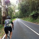 March 1, 2012 Episode 17: Beach Road vs. Mt. Dandenong
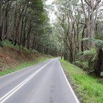 December 16, 2011 Episode 4: flying solo (up the 1 in 20)
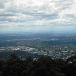 February 19, 2011 Episode 19: Return to the Dandenongs
 April 15, 2013 Crux: the Triple Crucifix (a Hells 500 epic)
After doing a few climbs a month ago (after discovering this website) i did the crucifix last weekend, the only climb that gave me difficulty was the devils elbow, i find it hits you hard straightaway and there is no relief until you get to one tree hill road.
So just so I get it right, the crucifix’s 4 climbs are the 1 in 20, sky high, devils elbow and the wall
Hi Brad. 1 in 20 then up to Sky High is one, Devil’s Elbows is another, and then there’s The Wall and Inverness Road.
Did you go back and pick up your car?!
Great post btw. Really enjoy reading about your rides.
You missed the bit where I said my partner picked up the car. Good spot though!
My bad.
I actually skim read it again before I asked so I didn’t miss it and didn’t pick it up the second time!
Another interesting write up.
Looks like the3Peaks preparation is going well. The Crucifix route can be described in many ways but the 4 key climbs are identical and all offer great training for the 3 Peaks event. Well done.