Route: Asheville to Mt. Mitchell return
Distance: 124km
Duration: 5 hours 6 minutes
Roughly ten hours after starting my journey, I started to wonder if it was worth the effort. I’d started the day in Washington DC and by the time I arrived in Asheville, North Carolina later that evening, I’d taken three trains, three buses, one interstate flight and one taxi.
How did I get there? Well, having returned to New York City after my trip to Lake Placid and having spent a few days in the US capital, I still had a few days to kill. I could take the easy option and head back to New York City before my brother Ash and I flew back to Melbourne on Saturday, or I could take the fiddlier, riskier and not to mention more expensive option and head to North Carolina.
Why North Carolina? Quite simply, because I’d heard the cycling was good. I’d had some contact with a guy called Aaron West who runs a terrific climbing website in North Carolina called SteepClimbs.com. When I got in touch with Aaron and asked his advice, his suggestion was to check out the Blue Ridge Parkway and base myself in the small city of Asheville.
So I did. And, as mentioned, it took plenty of fiddling to make work, but work it did. I hope to share even some of the beauty of the place here.
I arrived in Asheville on the Sunday but couldn’t get a hire bike until Tuesday. This wasn’t a problem as it gave me Monday to explore the town. It just meant that when I did get the bike, I had to make the most of the two days I had it.
On day one I caught the bus to a bike shop on the outskirts of town. I got on the rental bike, backpack and all, and rode the 10km back to the hostel to get rid of the unnecessary gear. Before long I was on the road and heading for the Blue Ridge Parkway.
A quick bit of information about this stunning road. Running from Rockfish Gap near Waynesboro, Virginia (northern end) to the Cherokee Indian Reservation in North Carolina (southern end) the Parkway covers an incredible 755km. It’s closed to commercial vehicles and other roads intersecting with the Parkway seem to be few and far between.
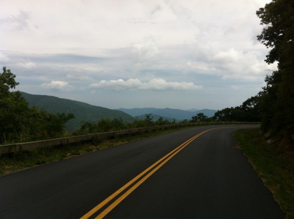
All of this means you’ve got a road that carries minimal traffic, and the few cars that I did see seemed to be tourists, happy to take it easy, giving this cyclist plenty of room while enjoying the views.
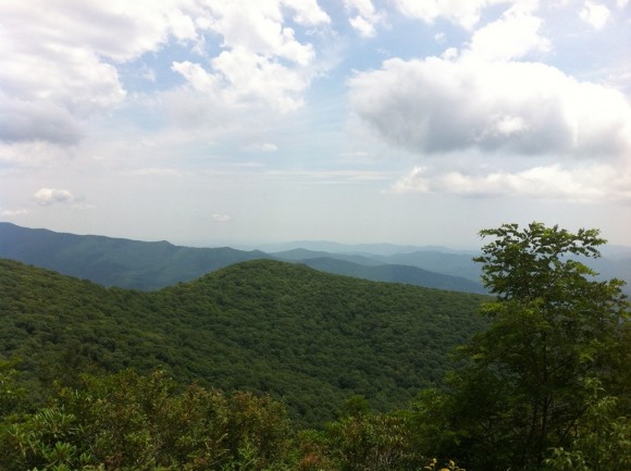
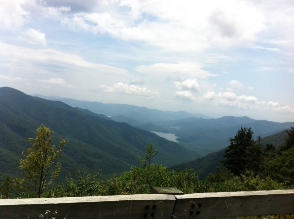
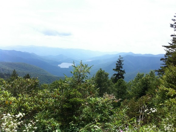
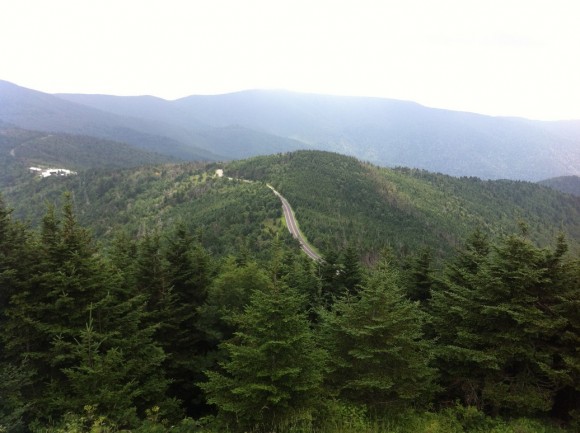
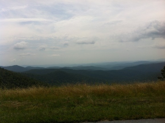
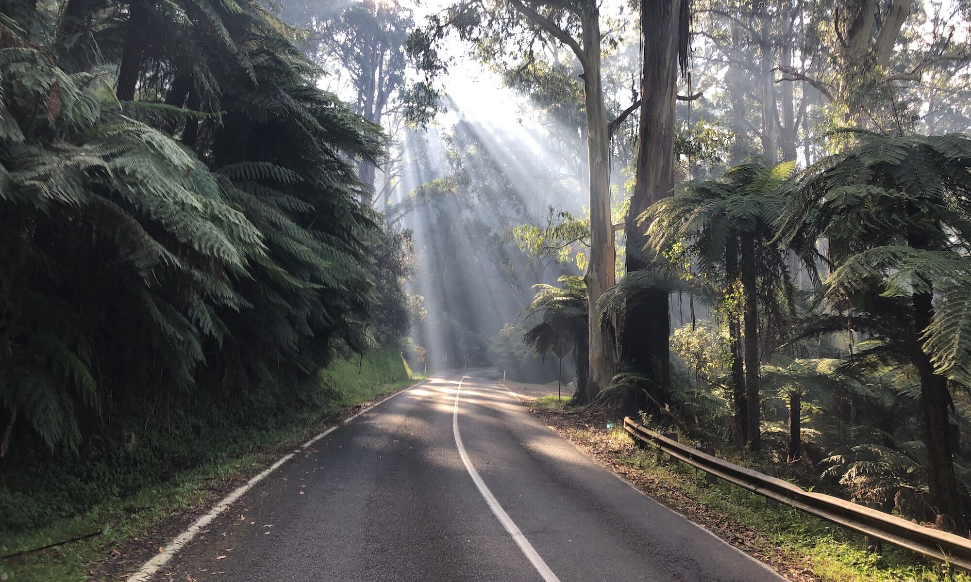
Oh man, the views. As always, pictures will never capture the full beauty of the place but hopefully the included images give you some sense of how gorgeous this part of the world is.
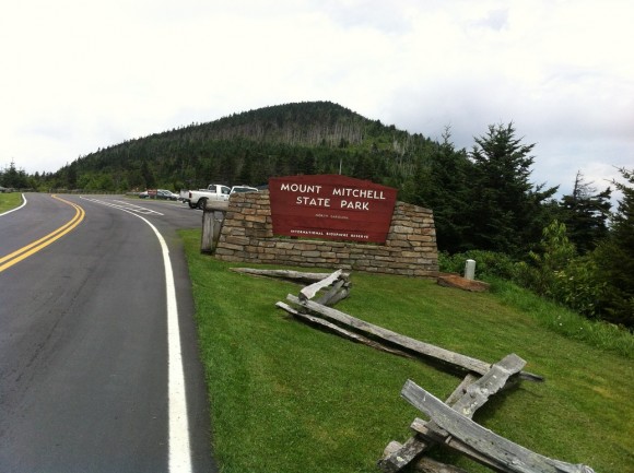
My goal on Tuesday, as recommended by Aaron, was to climb the 2,037-metre-high Mt. Mitchell, the highest peak in the eastern United States. From a quick look at Strava and from Aaron’s warnings I knew I was in for a long climb — from the point I entered the Parkway to the summit of Mt. Mitchell was 50km, more than 35 of it uphill.
As I started out on the Parkway I tried to concentrate on finding a rhythm. I was going to be spending the next few hours climbing so I might as well get comfortable, right?
The Parkway seems to provide a great mix of forested riding and ridge-line riding, based on the comparatively small slice of the road that I saw anyway. You’ll be tapping away through the forest for several kilometers before you reach an opening in the trees and spectacular views to the valley below. And then, before you know it, you’re riding through the lush canopy again.
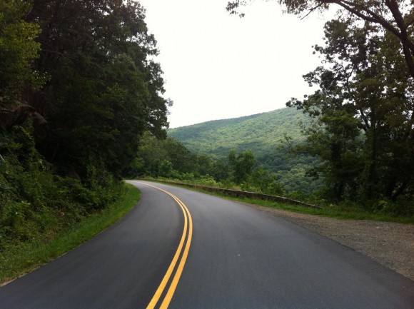
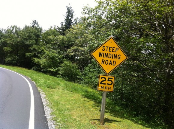
The climb toward Mt. Mitchell was rarely steep and there were a bunch of flat spots where I could sit up and take a breather. That said, I still found it tough going and the sheer length of the climb made it more difficult than the average gradient of 2.6% would suggest.
About three-quarters of the way through the climb I emerged from the trees to spectacular views on both sides of the road. The only problem was that the views were slightly ruined by a dark smudge in the sky. My heart sank a little as I looked at the clouds, remembering the soaking I got while on my quest to conquer Whiteface Mountain.
I tried to psych myself up for the rain, telling myself it didn’t make the riding any harder, I’d just be wet from the rain, instead of sweat. Thankfully, the rain never came and I was able to get through the ride being drenched only by sweat.
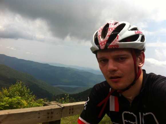
A sustained downhill section after the weather scare took me to the Mt. Mitchell turn-off. For the first time in several hours I left the Blue Ridge Parkway and started climbing the final 7.2km to the summit. In one of his emails, Aaron had said to me:
The one thing about Parkway climbing is the road rarely exceeds an 8% grade. They are long climbs, but not terribly difficult.
But the moment I left the Parkway things got a little more challenging. Those final kilometres to the summit only have an average gradient of 5.5% but this doesn’t reflect the toughness of the first section. They might only be 8 or 9% as well (my Garmin was reading 12% but I’m convinced it overestimates) but the climbing is sustained and after several hours of climbing it was far from easy.
A couple of false flats on the way to the summit gave me a chance to rest before one final push to the top. It was definitely satisfying to get to the top having spent so long climbing.
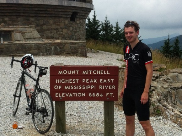
At the end of the road I got off the bike and walked to the summit to take some photos. A friendly bloke at the top offered to take the photo of me that you see below before his mate asked ‘Are you British?’ A few minutes later another lady got a bit more granular and asked ‘Where in Britain are you from?’
In five weeks in the US not one person accurately placed my accent. At least the folks atop Mt. Mitchell didn’t get Australia mixed up with a country on the other side of the world.
The long descent was nothing short of fantastic. For what felt like an hour I was able to rest on the bars and enjoy great views as I headed first back to the Blue Ridge Parkway and then back toward Asheville. Of course, if a climb’s got 11km of descending on the way up, as this one did, you’re set for some climbing on the way back down.
I reckon there were two sections of about 5km each and one shorter section, and all of them hurt. It’s been a while since I’ve done ~50km of climbing in a day and so every climb felt like a real effort just to keep the legs from cramping up and the heartrate from spiking into the red.
But I got through each uphill section and each climb was followed with another terrific descent. At Town Mountain Road I took a right and left the Parkway, descending this great road back to Asheville. More than five hours after setting off from the bike shop in south Asheville, I arrived back at the hostel, tired but extremely satisfied.
Route: Asheville to Mt. Pisgah loop & Town Mountain Road climb
Distance: 122km
Duration: 5 hours 24 minutes
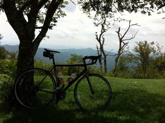
The last time I rode 100km on consecutive days was back in January when my brother Brendan, the Donvale Demon and I all stayed at Falls Creek and rode the front of the mountain, the back of the mountain and Mt. Hotham in three days. And while by body mightn’ve been thrilled with the idea of another five hours on the bike last week, I was certainly keen to make the most of my time in Asheville.
I set off mid-morning and headed south through town and on to the Blue Ridge Parkway once more. I was headed in the opposite direction to the ride I did the previous day, with the goal being to climb Mt. Pisgah. As Aaron wrote in his emails, Blue Ridge Parkway climbs don’t seem to be that steep and at ‘only’ 23.5km long, the ride from Asheville to Mt. Pisgah would be a doddle compared to Mt. Mitchell.
I struggled to find a rhythm for the first hour of the day, my legs whinging about being called into action the day after a tough day in the saddle, but once I started climbing, I felt fine. As with the climb to Mt. Mitchell, the climbing wasn’t consistent and there were many opportunities to sit up, rest and enjoy the wonderful landscapes.
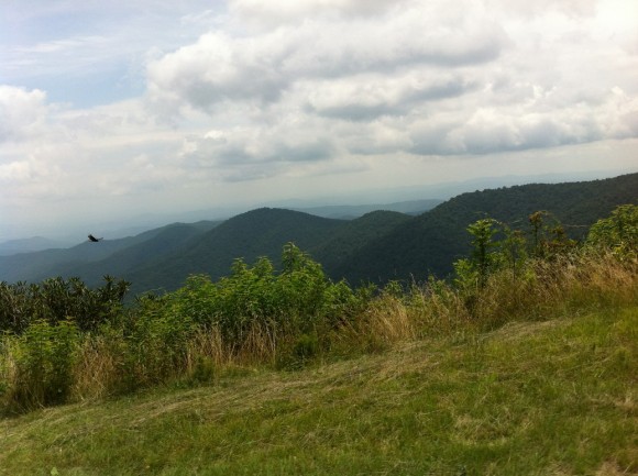
One of the defining features of the Parkway sections that I rode was the prevalence of tunnels that cut through the mountain range. The first few tunnels you come to are pretty exciting — ‘I’m riding inside the mountain!’. And then you get to a tunnel in which the light from the two ends doesn’t meet. In other words, you’re riding in pitch darkness and uphill, just to make it even more interesting.
I must admit I wasn’t expecting the tunnels and so I didn’t have any lights with me. So when I found myself in some of the longer tunnels, it really was a case of hoping that any cars passing through had their lights on and, more often than not, that the tunnel would just end. There was one particularly hairy moment.
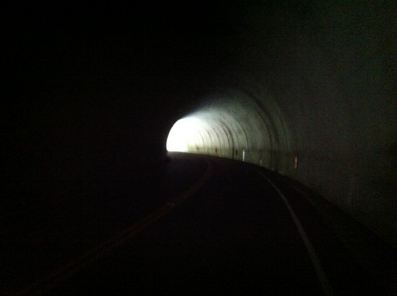
As I made my way into the longest tunnel of the day — maybe 400 metres long, around a left-hand bend — the light from the end behind me started to fade away. As I continued on there was no light at the end of the tunnel and I found myself in utter darkness, totally unable to see where I was going. At that exact moment I heard a car enter the tunnel behind me.
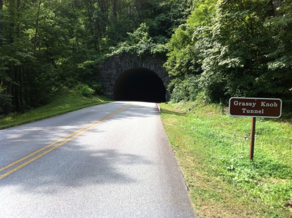
I was confident they’d have their lights on, but as the car engine got louder, the illumination in the tunnel didn’t increase. After a moment of panic, I decided I’d pull as far to the right of the tunnel as I could, leaning against the wall if need be. That way, if they didn’t have lights on (how could you not, right?) or if they came roaring through and didn’t see me, I’d be as far away from danger as possible.
But then it occurred to me that I couldn’t see how close to the tunnel wall I was. I had a vague idea, but I knew there was a small drop off – 10cm or so — at the edge of the road. I rode on, leaning to the right waiting for the drop and for contact with the wall.
All the while the car engine was getting louder, and there was no light to be seen ahead of me. After what felt like an age (but was probably only 15 seconds) the car behind me slowed right down. They’d spotted me. As they passed slowly by, they illuminated the rest of the tunnel and I was able to follow them out, taking a deep breath of relief as I did so.
The moral of the story: take lights with you when riding the Blue Ridge Parkway, even if you’re riding in the middle of summer!
I arrived at Mt. Pisgah a little under 90 minutes after starting the climb and after stopping to take some pictures, I headed to the local store for something to eat and drink. There were a couple of cyclists around at Mt. Pisgah, which was good to see, but it occurred to me then that I’d seen only one cyclist the previous day. That struck me as a bit weird.
Sure it was a weekday, but on a road as spectacular as the Parkway, surely more cyclists would be making the effort to get out? I’m sure you’d see more than a few cyclists out in the Dandenongs around lunchtime during the week.
After a quick snack break, I continued past Mt. Pisgah for a few kilometres, heading in search of a lookout tower I’d seen on a map earlier in the day. While I could see the lookout tower from the road, it turned out to be at the end of a nasty-looking gravel driveway so I didn’t bother. The photos from the Parkway were pretty cool anyway.
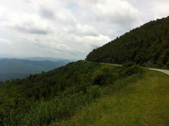
I climbed the 4km back to Mt. Pisgah and followed the road to a rare intersection; more specifically, the intersection with route 151. At that junction I took a left and started the magnificent descent back toward Asheville. Now I love climbing just as much as the next bloke, but a great downhill stretch is pretty hard to beat.
The descent of the 151 was one of the most technical and most challenging descents I’ve ever come across. It was also among the most enjoyable. The 151 winds sharply down the mountain with barely a straight section in sight, all the while taking you through some lush vegetation and all on a road that seems to carry basically zero traffic. Part of me was tempted to turn around and climb back up when I got to the bottom but with limited time before I had to return the bike and Town Mountain Road still to climb, I sadly had to give it a miss.
Where the climb to Mt. Pisgah and the 151 descent had been specatacular and wholly enjoyable, the 30km from the bottom of the mountain back to Asheville were anything but. Out of the mountains it was now roasting hot — 35° minimum — and I was riding through heavier, industralised parts of west Asheville. I’d planned out a route that ensured I avoided riding on a nasty highway but the trade-off was that I had 30km on lesser highways that left me desperate for the Parkway once more.
I’d like to say that I should have just descended the Parkway, retracing my steps, but then I would have missed out on the spectacular descent of the 151. So perhaps the 30km of hot, industrial drudgery were worth it?
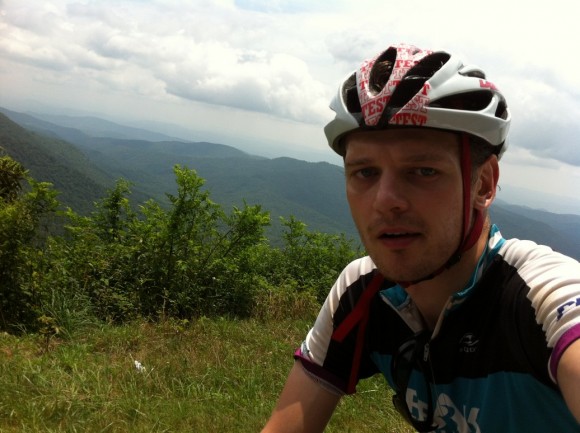
Back in Asheville I rode past the hostel and got stuck into the Town Mountain Road climb. I’d descended this climb the previous day and decided that I’d like to ride up it as well. In the heat and with heavy legs, the first few steep kilometres really took their toll and I was glad when the road flattened off. The climb is 8km long at a touch under 5% but there’s plenty of flat road in there, eroding the steepness of the other sections.
After 8km I reached the highest point of the road and rolled the final 2km down to the end of the road — it’s intersection with the Blue Ridge Parkway. As I sat in the shade having something to eat and drink I reflected on what a privilege it had been to ride on this great roadway over the past two days.
I also had a pang of jealousy as I remembered Aaron saying he and some mates are planning on riding the length of the Parkway (755km) in the near future. That would be some adventure.
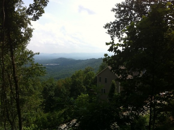
After getting back on the bike I climbed the 2km back to the top of the road and then enjoyed the wonderful descent back to Asheville for the second time in two days. By the time I got back to the hostel I was pretty tired, but my ride wasn’t done yet. I had to get my backpack and return the bike to the shop in south Asheville.
I managed to get a huge staple right through the back tyre in the final 2km of the ride, but after riding it out (‘Ah, that’s why it felt hard for the last few kays!’) I mentioned it to the bike shop folks and they were happy to fix it up, free of charge. Win!
I took a taxi back to the hostel and chatted with the driver about Australia and how fighting kangaroos isn’t such a great idea. He was particularly fascinated by how many of the world’s most poisonous animal species we have in Australia (as were a number of other Americans on this trip). I explained that while it’s true, we do have some nasty critters here, they play far less of a role in everday life than a lot of foreigners (including the great author Bill Bryson in his terrific book Down Under) seem to realise.
At the start of this blog entry I spoke about the hassle of getting to Asheville and, to be honest, the way back was even worse. The day after my last ride I took a taxi to the Greyhound station, a bus from Asheville to Winston-Salem, another bus to Charlotte, a local bus to the Charlotte airport … and that’s when things got interesting.
Due to a huge storm rolling through New York (where I was heading to rendezvous with my brother Ash ahead of our return to Australia) my 5.45pm flight was delayed by an hour and then eventually cancelled. I got a ticket on the next available flight to NYC — at 6.35 the next morning — and I was put on the stand-by list for the full 10pm flight. That particular flight was delayed by an hour and a half due to the storm as well and so it was 11.30pm before I even knew if I’d be able to get to NYC that night, or if I’d be sleeping the night in the airport.
Luckily, a few seats had opened up and I was able to get to New York by around 1.30am. It was 3am by the time my head hit the pillow in the awful hostel I was staying at meaning I’d spent more than 19 hours that day in transit. Add to that the 12 hours I’d spent getting to Asheville a few days earlier and you’re looking at a serious time investment just for a couple of rides.
But was it worth the effort? Absolutely. I had a terrific couple of days in and around Asheville, not just on the bike, and I’d gladly visit again. I just need to find a way to make some money out of riding and writing up the best climbs around the world and I’ll be laughing. Anyone got any ideas how to make that work?
Thanks to you all for reading and for the positive comments, both here and on Strava, Twitter, Facebook and via email. A huge thank you to Aaron West from SteepClimbs.com for the motivation to head to Asheville and for his terrific advice. I hope he visits Victoria one day soon so I can return the favour!
Until next time, stay safe on the roads.

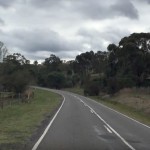
Hi Matt, I stumbled upon your while searching for images under ‘light at the end of the tunnel’ subject. Would you permit me to use this photo of the tunnel on this page as a book cover for a novel in Hindi that I have written, please?
Kind regards,
Y. Kumar.
Hi Yukesh, go for it. Would love to see the book once it’s done!
Hi Matt,
I own and operate the pre-eminent bicycle tour provider in Southern US. I focus primarily on strong recreational and serious cycling enthusiast and although I am based outside of Asheville I have been lucky enough to lead tours from Hawaii to Maine.
I would welcome the opportunity to “sponsor” your desire to cycle the full length of the Blue Ridge Parkway if you can figure out a way to “sell” an article of the experience to one of the leading Cycling publications such as Bicycling, Velo News… I lead 3-4 such full traverses a year.
Cheers,
Paul Wood
Black Bear Adventures Bicycle Tours
Bicycle Tours for the Avid Cyclist
http://www.blackbearadventures.com
Toll Free – 888.339.TOUR (8687)
Hi Paul. Thanks very much for this. I’ve sent you an email in reply. Did you get it?
Matt, glad you were able to climb Mt Mitchell and Mt Pisgah. I am friends with Aaron. The route to Mt Pisgah is also beautiful in autumn (as is the whole of the Blue Ridge Parkway). I remember the long tunnel, as I had a totally inadequate headlight, though I did have two good red blinkies in back. I also was disoriented in the pitch black! Glad you had a safe ride.
John
Thanks John. I’m replying to your comment from my desk at work back in Melbourne and cycling the BRP is sounding pretty appealing right now! That tunnel was scary, but no harm done. 🙂
Enjoyed reading about your adventure! The photos were splendid.
Greenville, SC
Thanks Janet!
I am thrilled that you had such a great time. And yes, you may hold me personally responsible for the tunnels. 🙂 Most of them are not bad. The only other long one is further down the Parkway near Waynesville. I have only driven the route to Pisgah, so I was not aware how difficult it is to navigate. If I don’t have a light, I’ll use a cell phone app to illuminate my way.
That’s a lot of climbing for two days. I might have suggested that you descend back to Asheville via the Parkway, but sounds like you had a nice descent.
Hope you enjoyed Asheville. It is one of my favorite Southeastern cities.
Hey Aaron, I was only joking about holding you responsible! It turned out totally fine in the end and make for a good story I think!
Matt:
I enjoyed your description of the BRP rides you did. Aaron told me about you
and I suggested to him that you rent a bike at Liberty. Did you? I would like to know
how the bike rental experience went for you in Asheville.
I really feel bad that Aaron failed to tell you about the tunnels. Especially the
“black”ones. I know how scary that is riding in the dark , wondering if you are ever going to hit the side wall or something.Glad you made it. It is against the law to ride those tunnels with out lights. (Of course Australians are known for their lawlessness right?) Just kidding.
I live in Spartanburg, a town south of Asheville in South Carolina and
have been riding the area since 1999. Our local club sponsors a century ride from Spartanburg to the top of Mt. Mitchell every spring, the “Assault on Mount Mitchell”. It is a real test.
Southwest of Asheville is a state park, Table Rock State Park. Every spring Canadian cycling teams descend on Table Rock to train in the mountains around it. It gets warm enough for them in March.They have cabins to rent. at the park If you are ever back in the area,
let me know . Our group could show you many more routes worth trying out. There is a club in Asheville, the Blue Ridge Bicycle Club ( not the
Roanoke, Virginia club with the same name). That club has a website and on the website is a place called “cue sheets” or something like that and there are a great number of great maps with elevation profiles alongside
to give you an idea of places to ride. CHeck it out.
Ride safe.
Bill Reichert
Hey Bill, thanks for all your help. I went to Liberty, yeah. They were really good. Lol re: the tunnels. I certainly don’t blame Aaron – I should have done more research about the road. And it all ended up fine anyway, so no harm done!
I’ve read a bit about the Assault on Mt. Mitchell. Sounds like a really tough ride!
Thanks again Bill, I hope to get back over to NC again soon!